Railways
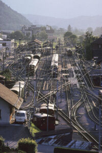
Railroad tracks in evening light, Meiringen, Berner Oberland, Switzerland. (Photo copyright © by Kaj Halberg)
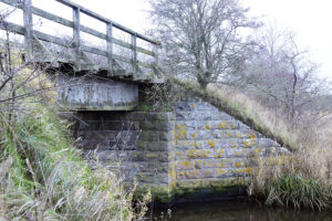
Former railway bridge, spanning the Vindinge River, eastern Funen, Denmark. This bridge was part of the railway between the cities of Nyborg and Svendborg, operating from 1897 until 1962. (Photo copyright © by Kaj Halberg)
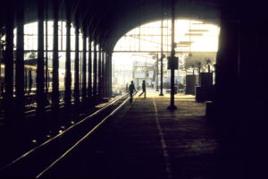
Early morning at Chennai Railway Station, Tamil Nadu, India. (Photo copyright © by Kaj Halberg)
Chile
One evening, during a car trip around Chile, my companion Lars Skipper and I pitched our tents at a railroad track near the city of Antofagasta, as we were unable to find a more suitable place for camping. During the night, a freight train passed by at a snail’s pace, and the ground was shaking so much that I felt it was coming right through my tent!
An event from our trip is related on the page Travel episodes – Chile 2011: The white forest.
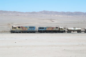
Freight train, moving at a snail’s pace across the Atacama Desert, near Antofagasta. (Photo copyright © by Kaj Halberg)
Denmark
Over the years, the city of Nyborg, Funen, has had 4 railway stations, of which the first one was inaugurated in 1865, when a railroad between Nyborg and the city of Middelfart had been built.
However, its location near Nyborg Castle was unpractical for shipping, and in 1871 the building was torn down and rebuilt in a similar style near the old harbour. It was functioning until 1891, when the third railway station was inaugurated. This one was in use until 1997, when the present station was inaugurated in connection with the building of the Storebælt Bridge.
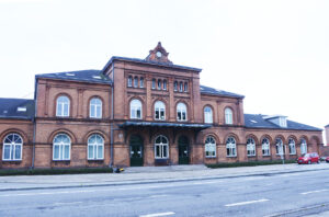
The third railway station in Nyborg, today used as offices and private habitation. (Photo copyright © by Kaj Halberg)
Aarhus Central Station was built in 1927. In Danish, it is labelled sækbanegård (‘sack railway station’), which means that the trains must leave the station by the same tracks they used when coming in. It is a very busy railway station, servicing more than 6 mio. passengers per year.
Aarhus Central Station. (Photo copyright © by Kaj Halberg)
In the late 1800s, a railway was constructed between the cities of Nyborg and Svendborg, eastern Funen. It was operating until 1962.
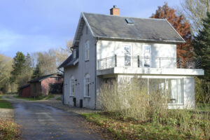
Former railway station in the village of Frørup, today a private residence. During the years when the railway was operating, the red buildings in the background were warehouses. (Photo copyright © by Kaj Halberg)
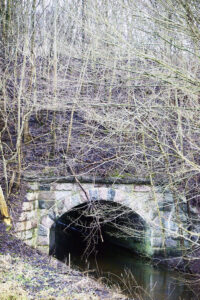
Today, the railway between Nyborg and Svendborg has been invaded by bushes and trees. This picture shows a bridge, spanning the Ørbæk River near the village of Bynkel. Another bridge on this railway is seen atop this page. (Photo copyright © by Kaj Halberg)
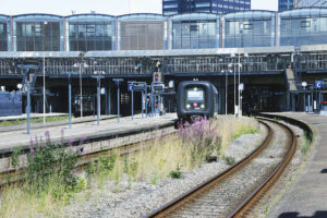
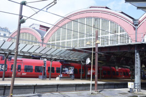
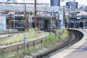
Copenhagen Central Station was inaugurated in 1911. It services more than 100,000 passengers daily.
Copenhagen Central Station. (Photos copyright © by Kaj Halberg)
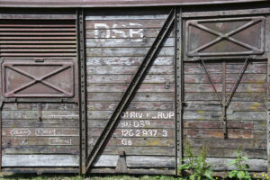
Discarded van from DSB (Danske Statsbaner = Danish State Railways), now functioning as a tool shed, Jutland. The plant to the right is blunt-leaved dock (Rumex obtusifolius). (Photo copyright © by Kaj Halberg)
France
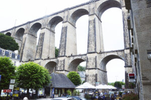
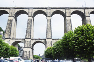
This viaduct, built 1861-63, is a railway bridge, crossing a valley in the city of Morlaix, Brittany. (Photos copyright © by Kaj Halberg)
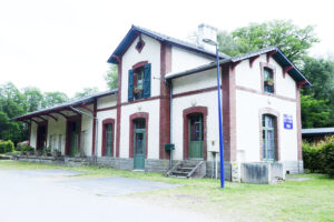
Former railway station, today functioning as a hotel, Scrignac, Brittany. (Photo copyright © by Kaj Halberg)
India
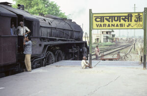
Old-fashioned steam engine, Varanasi Railway Station, Uttar Pradesh. (Photo copyright © by Kaj Halberg)
Passengers, waiting for trains, Varanasi. (Photos copyright © by Kaj Halberg)
Railway coolie at work, Varanasi. (Photo copyright © by Kaj Halberg)
The Nilgiri Mountains constitute a part of the Western Ghats, a mountain range, which stretches most of the way along the west coast of India, from Goa south to the southern tip of the subcontinent. The highest point in the Nilgiris, Dodabetta, reaches a height of 2,637 m.
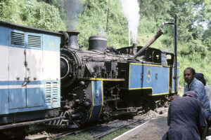
Towards the end of the 1800s, a narrow-gauge railway track was constructed, heading out from the small town of Mettupalayam in the state of Tamil Nadu, leading up through the Nilgiri Mountains, via Coonoor, terminating at the hill station Ootacamund (Ooty). This steep railway is operated by a small blue steam train, the Nilgiri Mountain Express.
Over a distance of 46 km, the terrain rises from c. 300 to c. 2,200 m altitude, the tracks passing through 16 tunnels, and across 31 larger and c. 200 smaller bridges. The lower mountain slopes are covered in tropical monsoon forest, and this area is full of waterfalls. Above c. 1,400 m, the forest gives way to plantations of tea, pines, and eucalyptus.
Nilgiri Mountain Express. (Photo copyright © by Kaj Halberg)
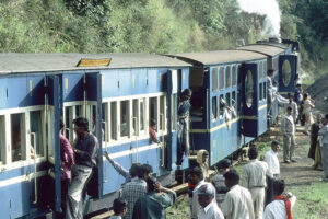
Passengers have disembarked during a break at a tiny mountain station. (Photo copyright © by Kaj Halberg)
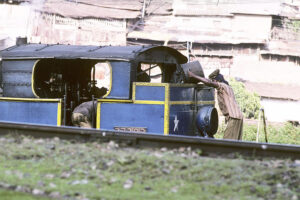
Coal is loaded onto the engine at Coonoor. (Photo copyright © by Kaj Halberg)
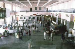
Passengers in the waiting hall, Varanasi Railway Station, Uttar Pradesh. (Photo copyright © by Kaj Halberg)
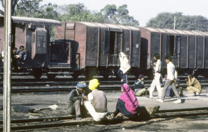
Time for a chat at railroad tracks, Jaipur Railway Station, Rajasthan. (Photos copyright © by Kaj Halberg)
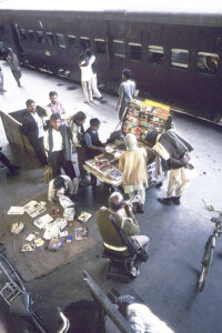
Book seller, Varanasi Railway Station, Uttar Pradesh. (Photo copyright © by Kaj Halberg)
Italy
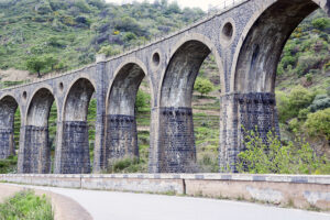
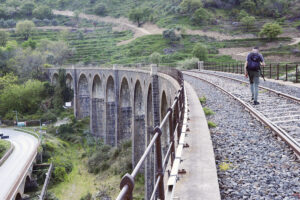
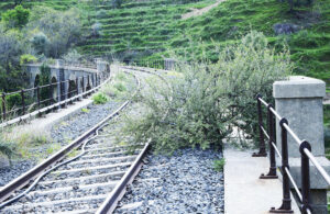
In former days, a railway led across this beautiful bridge near the small town San Cataldo, Sicily. The railroad is now out of use, and vegetation has invaded it.
(Photos copyright © by Kaj Halberg)
In this picture, an olive tree (Olea europaea) has sprouted along the railway. (Photo copyright © by Kaj Halberg)
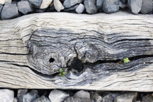
Pattern in a tie along the abandoned railway. (Photo copyright © by Kaj Halberg)
New Zealand
The railway between Ohakune and Raetihi, North Island, was completed in 1912. Prior to that, passengers would disembark at Ohakune and go by stage coach to Raihiti (or vice versa).
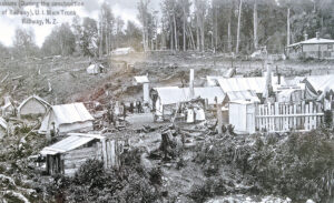
During construction of the railroad, living conditions in Ohakune were quite basic. Many workers stayed at Mrs. Fraser’s Boarding House, shown in this postcard, depicted on an information board in Ohakune.
Passengers, disembarking the train from Wellington at Ohakune Railway Station, with coaches waiting to bring them down the Old Coach Road, 1908. This picture was published in Auckland Weekly News, November 5, 1908, here depicted on an information board in Ohakune.
Iron sculpture in Ohakune, commemorating the period of the Old Coach Road. (Photo copyright © by Kaj Halberg)
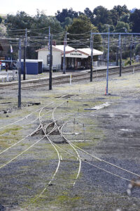
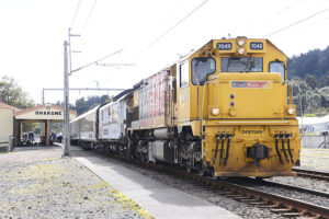
Ohakune Railway Station, as of today. (Photo copyright © by Kaj Halberg)
Modern train, Ohakune Railway Station. (Photo copyright © by Kaj Halberg)
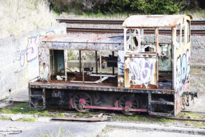
Scrapped train engine, Ohakune Railway Station. (Photo copyright © by Kaj Halberg)
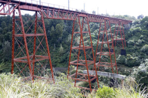
The Makatote Viaduct near Ohakune is a steel truss railway bridge, 262 m long, which spans the Makatote River, 79 m above the water. When this bridge was constructed in 1905-1908, it was the tallest viaduct in New Zealand. Today, the Mohaka and North Rangitikei viaducts are taller, at 95 and 81 m, respectively.
(Photo copyright © by Kaj Halberg)
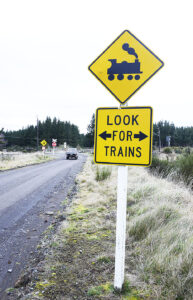
This sign near Karioi, North Island, warns about an ungated level crossing ahead. (Photo copyright © by Kaj Halberg)
Switzerland
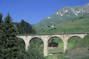
Railroad bridge, near Sedrun, Tavetsch Valley, Graubünden. (Photo copyright © by Kaj Halberg)
Taiwan
Originally, the Jiancing Line Lumber Transportation Track, eastern Taiwan, was about 5.5 km long. As its name implies, it was constructed to bring out timber from the Taipingshan Mountains, which today constitute the Taipingshan National Forest Recreation Area. The Jiancing Historic Trail was established along remains of this old railroad track, where, besides the tracks themselves, one may see skids, switches, trolley axles, and deserted workers’ dwellings.
The name jiancing means ‘seeing the sun’, possibly given due to the fact that this area is often enveloped in fog, and finally seeing the sun breaking through the fog might be relieving.
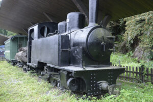
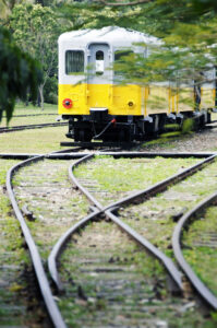
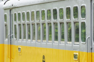
Preserved steam engine and passenger wagons, Taipingshan National Forest. (Photos copyright © by Kaj Halberg)
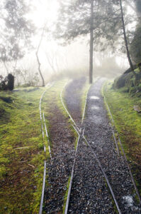
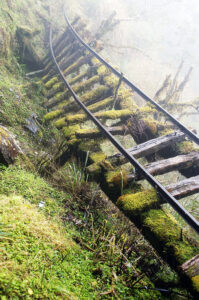
Railroad tracks, overgrown by mosses, Jiancing Historic Trail. (Photos copyright © by Kaj Halberg)
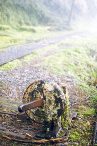
Rusted switch, Jiancing Historic Trail. (Photo copyright © by Kaj Halberg)
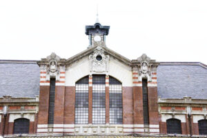
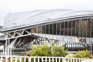
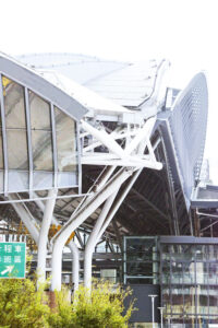
The old (top) and the new railway station in Taichung. (Photos copyright © by Kaj Halberg)
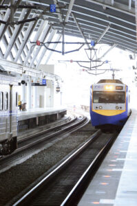
An arriving and a leaving train at Taichung Station. (Photos copyright © by Kaj Halberg)
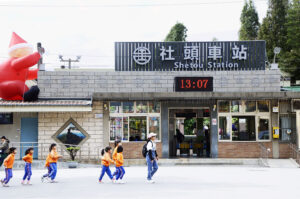
The railway station in the town of Shetou, between Changhua and Chiayi. The huge balloon to the left, depicting Santa Claus, announces the approaching Christmas. (Photo copyright © by Kaj Halberg)
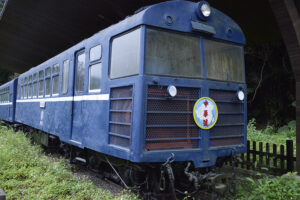
Old passenger wagon in the city of Taitung, today a museum. (Photos copyright © by Kaj Halberg)
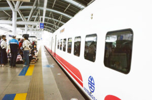
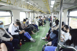
Passengers in the train between Chiayi and Houli. (Photo copyright © by Kaj Halberg)
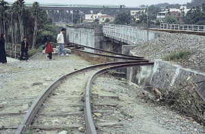
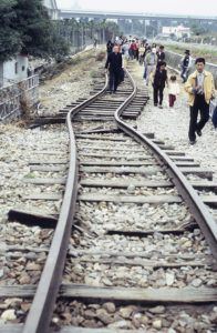
The huge Jiji earthquake, which occurred in Nantou County on September 21st, 1999, was the second-deadliest earthquake in the recorded history of the country, killing 2,415 people and injuring about 11,300. The damage done was estimated at ten billion US$.
These railroad tracks were bent during the huge Jiji earthquake. Today, this spot has been preserved as memorial. (Photos copyright © by Kaj Halberg)
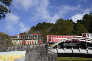
The Alishan Forest Railway is a narrow-gauge line, 86 km long, originally constructed in 1912 by the Japanese Colonial Government in Taiwan to transport logs from the Alishan Mountains in the central part of the island. Passenger carriages were first added to the trains in 1918. The original steam locomotives have now been replaced by modern diesel engines. This line is unique, with its Z-shaped switchbacks, more than 50 tunnels, and 77 wooden bridges. Today, it is a popular tourist attraction, bringing passengers to the Alishan National Forest Recreation Area.
Modern diesel locomotive, with a friendly engine driver, crossing the railway bridge, which passes over the main entrance to Alishan National Forest Recreation Area. (Photo copyright © by Kaj Halberg)
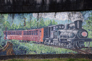
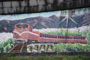
These mosaics, adorning the Alishan railway bridge, depict the former Alishan steam train, as well as the new diesel type train. (Photos copyright © by Kaj Halberg)
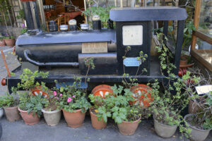
This small model, depicting a former Alishan steam engine, has been displayed as an eyecatcher outside a restaurant in Alishan. (Photo copyright © by Kaj Halberg)
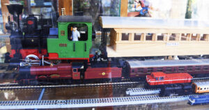
Various types of model railways, Alishan. (Photo copyright © by Kaj Halberg)
Tanzania
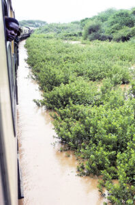
Railroad track, flooded due to heavy rainfall, near Dodoma. (Photo copyright © by Kaj Halberg)
Turkey
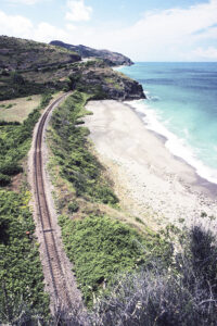
Railroad track near Filyos, Black Sea. (Photo copyright © by Kaj Halberg)
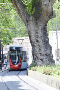
Metro train, passing by a huge oriental plane tree (Platanus orientalis), Sultanahmet, Istanbul. This magnificent genus of trees is described on the page Plants: Ancient and huge trees. (Photo copyright © by Kaj Halberg)
United States
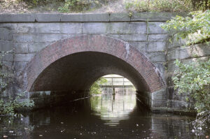
Beautiful old railway bridge, Beaver Lake, Long Island. (Photo copyright © by Kaj Halberg)
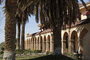
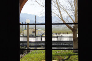
A former railway station in Mohave National Preserve, California, now functions as a visitor’s centre. (Photos copyright © by Kaj Halberg)
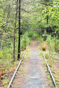
Tracks of a former railway, Pine Barrens, New Jersey. (Photo copyright © by Kaj Halberg)
Vietnam
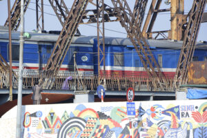
The Long Bien Bridge is a so-called truss bridge, spanning the Red River in Hanoi, Vietnam, in Vietnamese called Hong Ha (‘Red Sunshine’) or Song Cai (‘Mother River’). A truss is an assembly of beams, steel bars, or steel-enforced concrete blocks, which are connected to make a solid structure, often forming a pattern of numerous triangles. The steel truss bridge was a major engineering breakthrough, as it can span distances of over 460 m. (Source: en.wikipedia.org/wiki/Cantilever_bridge)
The Long Bien Bridge was constructed by the French in 1899-1902, using more than 3,000 Vietnamese workers. At that time, with a length of 2.4 km, it was one of the longest bridges in Asia. Cars are not allowed on this bridge, which is reserved for trains, scooters, and motorcycles.
Before the independence of North Vietnam in 1954, this bridge was called the Paul Doumer Bridge, named for Paul Doumer (1857-1932), the Governor-General of French Indochina 1897-1902, and later French president 1931-1932.
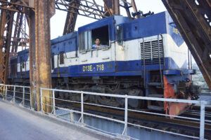
Trains, crossing the Long Bien Bridge. (Photos copyright © by Kaj Halberg)
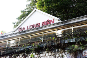
Long Bien railway station, established in 1902. (Photo copyright © by Kaj Halberg)
Road tunnel at Long Bien railway station. (Photo copyright © by Kaj Halberg)
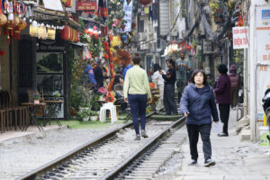
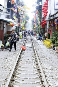
Hanoi Train Street is a narrow alley along a railroad, which was constructed in 1902 during the French colonial period, connecting Hanoi with Saigon (today Ho Chi Minh City) in the south. As time went by, houses were built closer and closer to the track, and today the trains pass very close indeed to the buildings. The alley is so narrow that local residents must remove their personal belongings, before a train passes. The track serves as a pedestrian street, and locals often sit on chairs on the track, drinking tea and playing games.
Hanoi Train Street. (Photos copyright © by Kaj Halberg)
Hanoi Central Station. (Photo copyright © by Kaj Halberg)
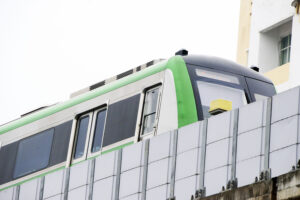
Metro train, Hanoi. (Photo copyright © by Kaj Halberg)
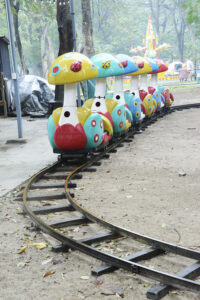
Toy train, Tran Nhan Tong Walking Street, Hanoi. (Photo copyright © by Kaj Halberg)
Zaire
Between October 1980 and March 1981, Steffen Madsen, Johnny Kristensen and I undertook a journey by car across Africa, from Morocco southwards to Zaire, thence eastwards to Tanzania and Kenya. As it turned out, this trip was very rewarding, but also very troublesome, mainly due to the terrible condition of the roads in Zaire.
While waiting for our visas for Zaire in Bangui, the capital of the Central African Republic, we made friends with five Germans, a married couple, Franz and Gizela, and their friend Albert, who drove in a small car, quite similar to our VW van, and Jürgen and Wolfgang, who were the proud owners of a huge, powerful Deutz truck.
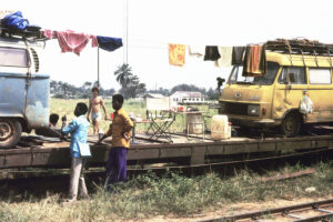
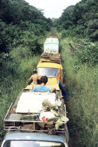
Together we travelled through Zaire, and when we had become utterly fed-up with the miserable roads, we decided to load the cars onto a train, travelling from Bumba to Isiro. As it turned out, this was a very relaxing trip, lasting four days. Most of the time, the train was moving at a snail’s pace, and from the top of the truck we could enjoy the landscape, alternating between forests, rivers, farmland, and villages.
I prefer the name Zaire instead of the official name of the country, the Democratic Republic of the Congo – a somewhat laborious name, I must say. And you can hardly place the term ‘democratic’ on a country that, for decades, has been pervaded by a chaos of violence.
Part of the journey, between Morocco and eastern Zaire, is related on the page Travel episodes – Africa 1980-1981: An arduous journey across Africa.
Locals are inspecting our cars, which have been loaded onto a railway wagon in Bumba. Johnny is seen in the background. (Photo copyright © by Kaj Halberg)
This picture shows a situation from our train journey, between Buta and Isiro. Steffen is reading on top of our van, in the background Franz. I took the picture from the roof of the truck. (Photo copyright © by Kaj Halberg)
A number of pictures, depicting native and naturalized plants along railroad tracks, are presented on a separate page, see Plants: Railway flora.
(Uploaded October 2019)
(Latest update December 2024)
