Kaj Halberg - writer & photographer
Travels ‐ Landscapes ‐ Wildlife ‐ People
Nepal 2009: Across a snow-covered pass
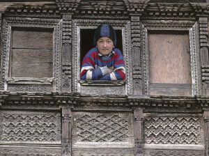
The main purpose of the trip is to photograph as many plant species as possible, which is the reason why I have chosen this otherwise hopeless time of the year to hike, with continuous rain, landslides, leeches, mosquitos, and other nuisances of the rainy season.
Above this village, we encounter fine broad-leaved forest with various trees, including oak, maple, and the large Rhododendron arboreum, which is the national plant of Nepal, called lali guras (‘red rhododendron’). Several clearings in this forest are the remains of former fields, which were abandoned when the national park was established, allowing the forest to regenerate.
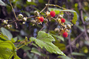
A couple of hours later, we reach the top of a small pass, Burlung Bhanjyang (2438 m), from where the trail leads down through forest and scrubland with a rich vegetation, comprising various bushes, including the beautiful Osbeckia nepalensis, of the family Melastomataceae, fragrant wintergreen (Gaultheria fragrantissima), which displays an abundance of sweet-smelling white flowers, and thickets of Rubus hoffmeisterianus, with red berries, which resemble raspberries, but has a slightly acid taste.
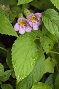
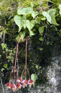
Herbs include the beautiful Henckelia urticifolia, of the gloxinia family (Gesneriaceae), and two species of begonia, Begonia picta and B. rubella.
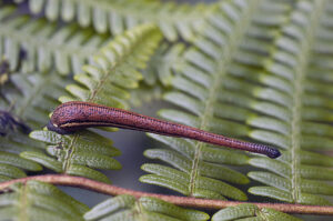
On our way, we often encounter leeches, which are a nuisance during the wet season. When a leech senses the carbon dioxide, expired by a warm-blooded animal, it will stretch out and try to attach itself to the skin of the animal. If undisturbed, the leech sucks blood for several hours and grows to several times its original size. It will then release its grip, fall to the ground, and wander off to lay eggs in the forest. The wound from a leech bite bleeds copiously for some time, but, apart from itching irritatingly, the bite is harmless to people.
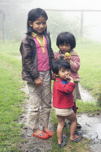
Until this point, we have only occasionally been bothered by rain, but now it starts pouring, so we take shelter in the first small hotel we encounter along the trail, in the hamlet Thodung Betini. As it turns out, the house owners are out working in the fields. Meanwhile, the eldest of their three sweet little daughters makes tea for us, and soon the parents return.
As it continues to rain for the rest of the day, we spend the night with this sympathetic family.
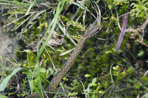
In the grass, I encounter a Himalayan keelback (Rhabdophis himalayanus), a species of grass snake, which is fairly harmless, although it may bite you. At least 50 species of snakes occur in the Himalaya, including several poisonous adder species, but they are rarely observed.
Above Kutumsang, we pass the entrance to Langtang National Park, whereupon the trail climbs steeply up through forest of oak and rhododendron to a hamlet, Sanu Gopte, across kharkas (grazing grounds in the forest) and a couple of small passes, and thence down to the village of Magingoth, altitude 3,200 m, which is surrounded by beautiful forest of Himalayan silver fir (Abies spectabilis).
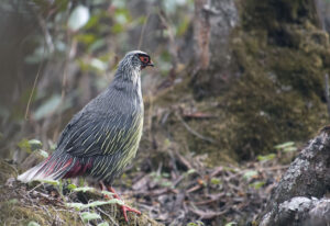
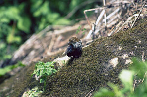
Continuing towards Tharepati, the trail leads through a lovely forest with a rich birdlife, including black-faced laughing-thrush (Trochalopteron affine), the diminutive, wren-like scaly-breasted wren-babbler (Pnoepyga albiventer), also known as scaly-breasted cupwing, and the verdigris-green fire-tailed myzornis (Myzornis pyrrhoura). The latter was formerly placed in the large babbler family (Timaliidae), but recent genetic research has shown that it is closer related to parrotbills (Paradoxornithidae). I also observe a small flock of the beautiful blood pheasant (Ithaginis cruentus), named for the red tear-shaped streaks on the breast of the male.
From the hotels in Tharepati, situated on a ridge at an altitude of 3,600 m, we have a gorgeous view towards mountains in Tibet, including Shishapangma, or Gosainthan (8013 m) – the highest mountain entirely within Chinese territory.
Past a group of hotels named Gopte, the trail leads up and down through a very stony area to another group of hotels at Ayethang (4050 m), from where we have to climb a very steep trail up towards a pass, Laurebina La (4609 m).
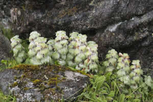
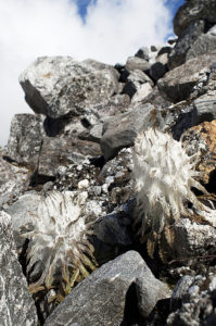
In the shelter of a rock, I find a small growth of Eriophyton wallichii, an extremely hairy high-altitude plant, belonging to the mint family (Lamiaceae). The hairy layer is an adaptation to protect the plant against cold and drought.
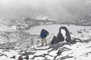
On our way towards the pass, we are surprised by a sudden snowfall, leaving a layer of slushy snow, which is far from pleasant to trudge through.
The trail continues along three lakes, Surya Kund, Ganesh Kund, and Bhairab Kund, all named after Hindu deities. The Gosainkund area contains a total of 54 lakes, which are all sacred to Hindus, and every year, during the July or August full moon, thousands of pilgrims undertake the strenuous hike to this area to bathe ritually in these lakes. Devout Hindus wish to bathe in all 54 of them. An interesting legend, describing the origin of these lakes, is related on the page Countries and places: Sacred lakes of Shiva.
Near the lake is a small group of hotels, of which only a single one is open at this time of the year. The caretaker is a sympathetic Tibetan woman, whose only company is a cook. She has just been paid a visit by a group of Israelis, who cheated her by paying for less that they had consumed – an act, which does not surprise me, as Israeli backpackers are notorious for their miserliness.
”Israeli people no good!” says the woman.
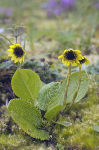
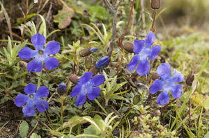
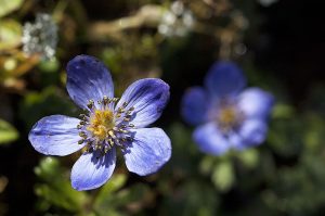
The following morning, I explore the flora along the lake shore. Many beautiful flowers grow here, including Cyananthus lobatus and Codonopsis thalictrifolia, both of the bellflower family (Campanulaceae), a gentian, Gentiana ornata, an edelweiss, Leontopodium jacotianum, and a lush bistort, Bistorta vacciniifolia.
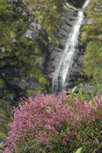
At Cholang Pati (3,600 m), situated on a ridge, we encounter two entirely different types of vegetation. While the dry southern side only has scattered juniper bushes, the sheltered north side is covered in a lush forest of old silver firs.
Around the village of Sing Gompa, named after a Tibetan Buddhist monastery (gompa), I notice many blackened tree stumps, which bear witness to a huge forest fire in the past.
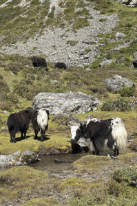
In this village, cheese is produced from milk, produced by naks (female yaks), which graze here during the summer months. This useful animal is described in detail on the page Animals – Animals as servants of Man: Cattle, banteng and yak.
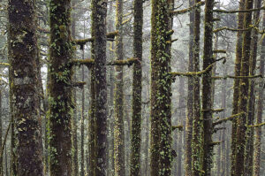
The trail down to the valley leads through terraced fields and forest. After a landslide we arrive at a couple of hotels at Pairo, popularly called Landslide, as a major landslide took place here some years ago. These hotels are situated at an altitude of only 1650 m, and it is steaming hot.
Birdlife in this area mainly comprises subtropical species like black bulbul (Hypsipetes leucocephalus) and blue-throated barbet (Psilopogon asiaticus). A short distance above the hotels, black bee nests are hanging on the rock face, and I am lucky to observe two yellow-throated martens (Martes flavigula), running along the rock wall.
As opposed to the lush forest on the southern side of the river, the northern side is very dry, facing the sun, the rocks covered in grass, mixed with numerous candelabra spurges of the species Euphorbia royleana.
A couple of hours later, we arrive at Bamboo Lodge, where two hotels were washed away by a stone- and mudslide in 2000. They have since been rebuilt, blending into the harsh landslide in a charming way. In the landslide, Nepalese alder (Alnus nepalensis) have been planted – a true pioneer tree, which readily grows in landslides and other eroded areas.
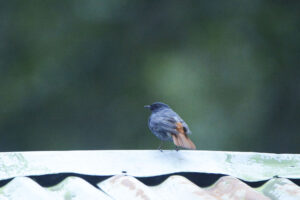
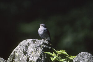
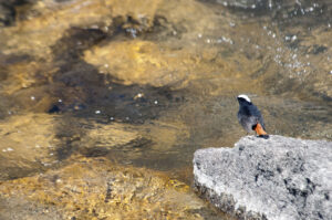
Another common bird is the white-capped river-chat (Phoenicurus leucocephalus), which is red and black with a white cap. Previously, this bird was placed in the genus Chaimarrornis, from the Greek kheimarrhos (‘torrent’) and ornis (‘bird’), relating to its habitat along fast-flowing streams.
As its name implies, the brown dipper (Cinclus pallasii) is a uniform brown, as opposed to the Eurasian species (C. cinclus), which has a white breast. Dippers mainly eats caddis fly larvae, catching them beneath the surface and extracting them from their ‘house’ on the river bank.
The blue whistling-thrush (Myophonus caeruleus) is a little larger than a European blackbird (Turdus merula), named for its beautiful song, which contains clear whistling sounds.
At Ghora Tabela (’Horse Stables’), at 2,950 m, the valley widens, and the forest is replaced by thickets of barberry (Berberis), roses, and other prickly bushes, indicating that many goats and yaks are grazing here.
The largest village in the valley is Langtang, situated at an altitude of 3,500 m. The major part of its inhabitants are Buddhists, which is obvious, judging from the many prayer flags, chortens (Tibetan style stupas), and long rows of mani stones, which are slabs of slate or other stones, inscribed with Buddhist mantras. These items, and many other aspects of Buddhism, are described on the page Religion: Buddhism.
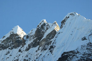
Behind the last ridge, at 3,900 m, is Kyanjin Gompa, surrounded by a number of hotels. From here, we have a fantastic view towards the highest mountain in the national park, Langtang Lirung (7,245 m), and two glaciers, Lirung and Kyimshung.
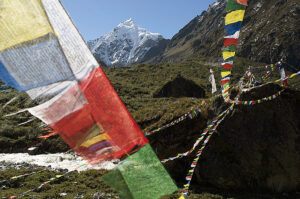
At Kyanjin Gompa, Tanka and I await the arrival of two porters, Raju and Tanka. As it turns out, the latter is a large man, whom I dub ‘Big Tanka’ to avoid confusion. When they have arrived, we continue up towards the end of the valley, where we camp a few days at Langshisa, near several large boulders, which have been adorned with countless prayer flags.
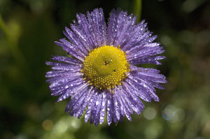
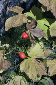
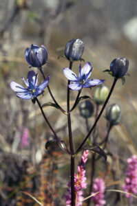
In this valley, I study the rich vegetation, comprising shrubs of the spiny Tibetan sea-buckthorn (Hippophae tibetana), and a large number of herbs, including a marsh felwort, Lomatogonium carinthiacum, a larkspur, Delphinium glaciale, and Himalayan may-apple (Sinopodophyllum hexandrum), the latter with attractive red fruits. This species, which belongs to the barberry family (Berberidaceae), is much utilized in traditional Ayurvedic medicine, and it is severely threatened by excessive collecting.
We now hike a bit downstream, crossing the river on a bridge, continuing on a trail, which leads through dense forest of Himalayan birch. Once out in the open again, we begin the steep ascent towards the Ganja La.
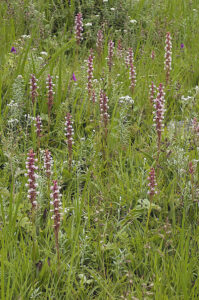
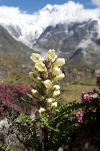
Soon we enter an open, grass-clad area, called Ngegang Kharka, which displays a rich flora, including a lousewort, Pedicularis scullyana, a monkshood, Aconitum gammiei, and a species of star gentian, Swertia cuneata. At an altitude of about 4,700 m, I encounter an extremely hairy composite, Saussurea gossypiphora – an adaptation to protect the plant against cold and drought. The genus Saussurea, of the composite family, contains at least 31 species in the Himalaya.
Although it is still early in the day, we make camp here, as it is wise to cross the snow-clad Ganja La early in the morning, when the snow is firm, making it easier to walk on.
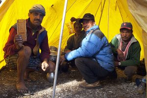
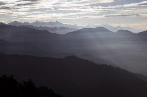
As it turns out, a landslide has destroyed the old trail, and the new one is fairly precarious, the last part of it, just beneath the top of the pass, being a narrow shelf, on which you have to cling to the perpendicular rock wall. However, we all manage to reach the top without mishap. The weather is fine, sunshine and wandering clouds, and the views are wonderful.
The descent is also far from easy. The sun is baking, and as Raju, Big Tanka, and the local porter didn’t bring sunglasses, they begin to suffer from snow blindness.
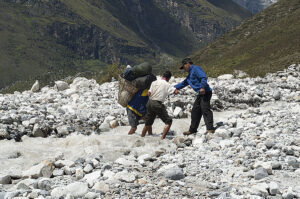
I’m lagging a bit behind, when, to my horror, I see the local porter fall off the trail and start sliding down a steep snow drift, in which rocks protrude here and there. As he has tied his burden to his shoulders with rope, he is not able to extract himself, sliding helplessly down the drift. On his way, he hits a rock, luckily with his body, after which his speed subsides, and he comes to a stop. Sasha, who is ahead of us, hurries along to help the porter, who, to my intense relief, has only had a few scratches and a couple of bent ribs.
Now it is Raju’s turn. He stumbles, causing his basket to fall off and disappear into a crevasse, surrounded by a huge snow drift. It is impossible to get hold of the basket again, which, unfortunately, contains most of our food. As the local porter cannot carry now because of his bent ribs, Raju takes over most of his load, but we have to leave some of it behind in the snow.
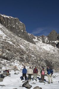
About an hour later, we arrive at areas devoid of snow, but hour after hour passes by, and all stone huts we encounter have been deserted – the herders have already descended into the valley with their animals.
Late in the afternoon, we are beginning to lose courage, and Raju, Big Tanka, and our local porter are now so snow blind that they can hardly see anything.
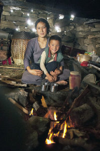
Then, to our immense relief, we observe smoke rising from a goth, which, as it turns out, houses a beautiful Tamang woman and her small son. (Her husband has gone into the valley to buy supplies.) She receives us very courteously, and we are allowed to make camp near her hut. We are able to buy rice and a few mustard leaves from her, making it possible for us to cook a simple meal. The woman also makes tea for us, with lovely, fresh yak milk – a heavenly drink in our miserable condition!
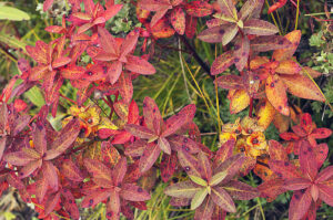
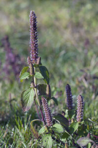
Our descent is quick, and in the afternoon we encounter another herder, who has remained in the grazing grounds. It is considerably warmer here, with shrubs of rhododendron and other bushes. The herbal flora is also different, comprising species like Anemone obtusiloba, fine-leaved groundsel (Senecio graciliflorus), and a species of late-summer-mint (Elsholtzia).
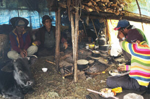
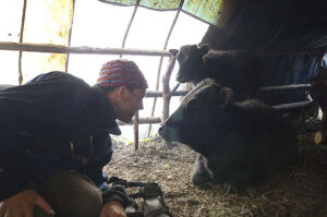
We get permission to camp near the herder’s large tent, in which we spend the evening. Obviously, he is happy to have company, as being a herder is often a very lonely job. In the morning, we watch him milking his dzopkios – a cross between cattle and yak, which thrives at lower altitudes than the yak, and also yields more milk.
After enjoying a cup of tea, we set out towards the village of Tharke Ghyang, reaching it late in the afternoon.
Most of the mentioned animals are described on the pages Animals – Mammals: Mammals in the Indian Subcontinent, and Animals – Birds: Birds in the Himalaya.

