Spectacular mountains
Morning light on Sassolungo (3181m), Dolomites, northern Italy. The tree is a Norway spruce (Picea abies), which is described on the page Plants: Ancient and huge trees. (Photo copyright © by Kaj Halberg)
Mount Meru (4565 m), seen from the city of Arusha, northern Tanzania. In the foreground a cactus-like spurge (Euphorbia). (Photo copyright © by Kaj Halberg)
The eastern side of Dhaulagiri (8172 m), the 7-highest mountain on the planet, glows in the morning sunlight. – Annapurna area, central Nepal. (Photo copyright © by Kaj Halberg)
Morning light on a spectacular mountain with alternating dark and light sedimentation, Mesa Verde, Colorado, United States. (Photo copyright © by Kaj Halberg)
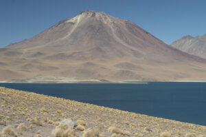
The area around the alpine lakes Lagunas Miscanti y Miñiques in the Chilean Andes is dominated by the Miñiques Volcano and the Cerro Miscanti Mountains. Formerly, there was only one lake, but a lava flow from an eruption of Miñiques formed a barrier between the two present lakes. This picture shows Laguna Miscanti and the Miñiques Volcano. (Photo copyright © by Kaj Halberg)
Europe
The Alps
The Alps stretches over about 1,200 km across southern Central Europe, from eastern France and Monaco across Switzerland, northern Italy, southern Germany, and Liechtenstein to Austria and northern Slovenia. These mountains were formed over a huge time span, as the African and Eurasian tectonic plates collided. The highest peak is Mont Blanc (4810 m), on the French-Italian border.
The Dolomites is a dramatic mountain area of numerous sharp peaks, situated in north-eastern Italy. These mountains consist of a carbonate rock, named dolomite. This mineral was named for French geologist Déodat Gratet de Dolomieu (1750-1801), who was the first person to describe it.
Sella group, seen from Val Gardena. The highest peak in this group is Piz Boè (3151 m). (Photo copyright © by Kaj Halberg)
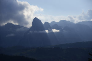
Morning clouds around peaks at Passo Falzarego. (Photos copyright © by Kaj Halberg)
Evening light on Monte Averau (2649 m), the highest mountain in the Nuvolau group, seen from Passo di Valparola (2192 m). (Photo copyright © by Kaj Halberg)
Other peaks around Passo di Valparola. (Photos copyright © by Kaj Halberg)
Evening light on Punta Penia (3343 m), the highest peak in the Marmolada group, and the highest peak in the Dolomites. (Photos copyright © by Kaj Halberg)
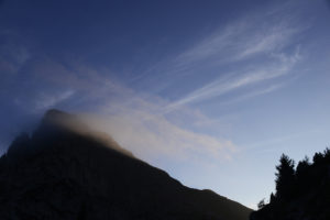
Clouds around Passo Pordoi (2239 m). (Photo copyright © by Kaj Halberg)
Jagged mountains around Passo delle Erbe (1987 m), in German Würzjoch. (Photo copyright © by Kaj Halberg)
The faucet at this watering trough in Lammartal, Salzburg, Austria, has frozen. The mountain range in the background is Gosaukamm, the highest point of which is Große Bischofsmütze (‘Large Bishop’s Mitre’) (2458 m). (Photo copyright © by Kaj Halberg)
Peaks in Gosaukamm. (Photo copyright © by Kaj Halberg)
Mountains around Lake Geneva (Lac Léman), Switzerland. (Photo copyright © by Kaj Halberg)
Mountains near Kasereck, Grossglockner, Austria. (Photo copyright © by Kaj Halberg)
Clouds around Schwarzmönch (2649 m), standing out in front of Jungfrau (4158 m), Lauterbrunnen Valley, Berner Oberland, Switzerland. (Photo copyright © by Kaj Halberg)
Morning sun on mountains near Kandersteg, Berner Oberland. (Photo copyright © by Kaj Halberg)
The Pyrenees
The Pyrenees is a mountain range in southern France and northern Spain, extending nearly 500 km from near the Atlantic Ocean eastwards to just north of Cap de Creus on the Mediterranean coast. The highest peak is Aneto (3404 m), in the central part. Most of the way, the main crest of the range constitutes the border between Spain and France, with the small independent state Andorra situated between the two countries.
Mountains around the village of Gourette, near Col d’Aubisque, French Pyrenees. (Photo copyright © by Kaj Halberg)
Waterfall, Cirque de Gavarnie, French Pyrenees. (Photo copyright © by Kaj Halberg)
Mountains around Cirque de Troumouse, French Pyrenees. (Photo copyright © by Kaj Halberg)
Grazing horses, Alto Gallego, Spanish Pyrenees. The domestic horse is described on the page Animals Animals in culture and religion: Equidae. (Photo copyright © by Kaj Halberg)
Other European mountains
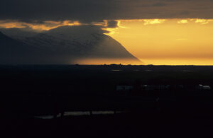
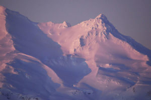
Snow-covered mountains in morning sun, Isafjörður, northern Iceland. (Photo copyright © by Kaj Halberg)
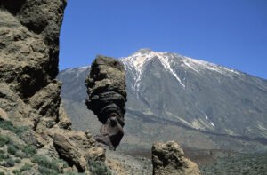
A number of spectacular rocks are centered around the Teide volcano in central Tenerife, at 3715 m the highest peak in the Canary Islands. The rock in the bottom picture has been dubbed Los Roques de Garcia, and popular names include ‘God’s Finger’ and ‘The Stone Tree’. (Photos copyright © by Kaj Halberg)
The Rock of Gibraltar, known as Mons Calpe in ancient times, got the name Jabal Tariq (‘Tariq’s mountain’) in 711 A.D., when the Berber general Tariq ibn Ziyad landed his army in southern Spain, marking the beginning of the Muslim conquest of Spain. In 1704, during the War of the Spanish Succession, the Anglo-Dutch fleet captured the rock, renaming it Gibraltar, and following the 1713 Treaty of Utrecht it became under British rule. Spain has still not made any claim to get it back.
The Rock of Gibraltar, seen from the ferry to Morocco. (Photo copyright © by Kaj Halberg)
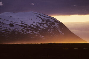
Kinnarfjöll (830 m) in midnight sun, Aðaldal, northern Iceland. (Photos copyright © by Kaj Halberg)
An alpine lake in front of Pen yr Ole Wen Mountain (978 m), Llyn Idwal, Snowdon National Park, Wales. (Photo copyright © by Kaj Halberg)
Roque Nublo (‘Rock in the Clouds’) is a striking volcanic formation in central Gran Canaria. It is 67 m high, and its top is 1813 m above sea level – the third-highest peak on the island, only surpassed by Morro de la Agujereada (1956 m) and Pico de las Nieves (1949 m).
A dramatic rock formation in the Roque Nublo area. The tree is a Canarian pine (Pinus canariensis), described on the page Plants: Ancient and huge trees. (Photo copyright © by Kaj Halberg)
Fornastaðafjall Mountain (904 m), reflected in a lake, near Akureyri, northern Iceland. (Photo copyright © by Kaj Halberg)
Mountains on Uíbh Ráthach (Iveragh Peninsula), south-western Ireland. (Photo copyright © by Kaj Halberg)
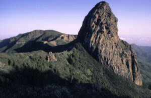
Morning light on El Rejo, a rock formation surrounded by subtropical evergreen forest, mainly consisting of laurel (Laura nobilis), La Gomera, Canary Islands. (Photo copyright © by Kaj Halberg)
Rain clouds above Glyder Fawr (999 m), Snowdon National Park, Wales. (Photo copyright © by Kaj Halberg)
Evening light on Bláfjall Mountain (1222 m), with Lake Mývatn in the foreground, northern Iceland. (Photo copyright © by Kaj Halberg)
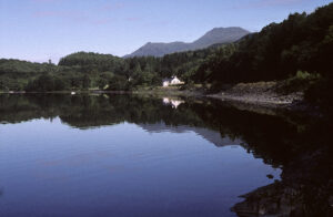
Ben Lomond (973 m), in Gaelic Beinn Laomainn (‘Beacon Mountain’), seen from Cashel, Loch Lomond, Scotland. (Photo copyright © by Kaj Halberg)
Africa
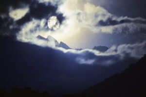
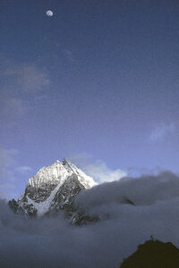
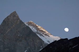
Full moon above the Ruwenzori Mountains, Virunga National Park, eastern Zaire. Since Ancient Greece, these mountains have been known as ‘Mountains of the Moon’. This area is described in depth on the page Travel episodes – Zaire 1981: The ghost forest. (Photo copyright © by Kaj Halberg)
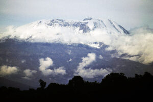
Mount Kilimanjaro (5895 m), highest mountain in Africa, seen from Arusha National Park, Tanzania, 1989. Today, there is much less snow on the top. (Photo copyright © by Kaj Halberg)
Entrance gate on the trail, leading up to Mount Sinai (2285 m), Egypt, in Arabic known as Djebel Musa (‘Mount Moses’). On this peak, according to The Book of Exodus, Moses received the two tablets with the Ten Commandments inscribed. (Photo copyright © by Kaj Halberg)
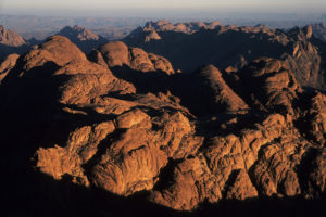
Morning light on mountains near Mount Sinai. (Photo copyright © by Kaj Halberg)
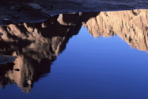
Mountains, reflected in a pond, Mount Sinai. (Photo copyright © by Kaj Halberg)
Mount Kenya is an extinct volcano in central Kenya, at 5199 m the second highest mountain in Africa, only surpassed by Mount Kilimanjaro (above). It has been estimated that prior to glaciation, it may have been more than 7,000 m high, but erosion by meltwater from its ice cap resulted in much eroded slopes and the creation of numerous valleys. The area was declared a national park in 1949, and in 1997 it was designated a UNESCO World Heritage Site.
A hike up this mountain is described on the page Travel episodes – Kenya 1989: A hike up Mount Kenya.
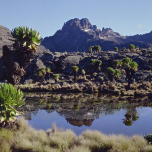
Alpine grassland around Lake Michaelson in the Gorges Valley, Mount Kenya, surrounded by a species of giant groundsel, Dendrosenecio keniodendron. The soaring mountain in the background is Batian (5199 m), the tallest peak in Kenya. (Photo copyright © by Kaj Halberg)
Dramatic rocks, soaring on both sides of Gorge du Seldja, near Metlaoui, Tunisia. (Photo copyright © by Kaj Halberg)
Misty desert mountains, near Nabq, Sinai, Egypt. (Photo copyright © by Kaj Halberg)
The Simien Mountains are situated in northern Ethiopia, northeast of Gondar. The highest point in these mountains is Ras Dejen (Ras Dashen) (4550 m). The plants are Ethiopian lobelias (Lobelia rhynchopetalum). (Photo copyright © by Kaj Halberg)
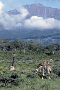
Meru (4565 m) is a striking mountain in Arusha National Park, northern Tanzania. This picture shows grazing giraffes (Giraffa camelopardalis) in front of the mountain. The pattern of the giraffes in this park is quite unique, and some authorities consider them a hybrid between reticulated giraffe, subspecies reticulata, and Masai giraffe, subspecies tippelskirchi. They are sometimes called Galana giraffes. The giraffe is described in depth on the page Nature: Nature’s patterns. (Photo copyright © by Kaj Halberg)
Dramatic rock formations in the Chimanimani Mountains, eastern Zimbabwe. (Photo copyright © by Kaj Halberg)
Asia
The Himalaya
The word Himalaya is derived from the Sanskrit hima (‘snow’) and alaya (‘abode’), thus ‘The Abode of Snow’. The Himalaya consists of a long arch of gigantic mountains, stretching from northern Pakistan southeast to the northern tip of Myanmar – a distance of more than 2,500 km. In these mountains are the Earth’s largest concentration of very high peaks, fourteen of which reach an altitude of more than 8,000 m, whereas hundreds are more than 7,000 m high.
The borders of the Himalaya are not well defined. To the northwest, the Karakoram Mountains (which some authorities consider a part of the Himalaya, others do not) merge into the Hindu Kush and Pamir Mountains. To the north and northeast, several mountain chains in Ladakh, Tibet, and China are a continuation of the Himalaya proper.
The highest peak on the planet, 8,850 m tall, is known as Mount Everest in the West,, whereas the Nepalese call it Sagarmatha, the Tibetans Chomolangma. It is situated in the landscape of Khumbu, eastern Nepal, on the border between Nepal and Tibet. Other very tall peaks in this area include Lhotse (8511 m) and Nuptse (7879 m).
View from the Dudh Kosi Valley, Khumbu, with Lhotse (8516 m, centre), Nuptse (7861 m, left), and Sagarmatha (8850 m), its peak just protuding behind Nuptse. The mountain to the far right is Ama Dablam (see below). (Photo copyright © by Kaj Halberg)
Clouds around Lhotse (8516 m), the 4-highest mountain in the world. The buildings glimpsed in the centre are the Tengboche Buddhist Monastery. (Photo copyright © by Kaj Halberg)
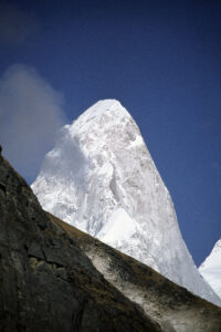
A very striking mountain in Khumbu is the double-peaked Ama Dablam (6812 m), which is sacred to the local Sherpa people. In Nepali, the name means ‘mother’s necklace’. The long ridges on either side of the highest peak are likened to the arms of a mother (ama), spread out to protect her child, whereas the hanging glacier on the mountain is likened to a dablam, the traditional necklace with a charm box, often worn by Sherpa women. (Photo copyright © by Kaj Halberg)
My late friend John Burke (1951-2010), who joined me on my first hike in the Khumbu, loved Ama Dablam. He took this striking picture, depicting Sherpa women passing in front of the snow-clad peak. Our hike is related on the page Travel episodes – India & Nepal 1978: Journey towards Everest. (Photo copyright © by Kaj Halberg)
The jagged peaks of Thamserku (6608 m), Khumbu. (Photos copyright © by Kaj Halberg)
This striking peak is Pumori (7145 m), situated near Sagarmatha. The dark hill in front is named Kala Pattar (5545 m). (Photo copyright © by Kaj Halberg)
Dark peaks in front of the snow-clad wall of Kangtega (6685 m), Khumbu. (Photo copyright © by Kaj Halberg)
Tibetan prayer flags, fluttering in front of the mountain Dragkya (5657 m), Gokyo Valley, Khumbu. On such prayer flags are printed Buddhist mantras, which are spread into the universe by the wind, to the benefit of mankind. (Photo copyright © by Kaj Halberg)
In 1976, an area of 1,710 km2 in central Nepal, comprising the Langtang Valley, the Gosainkund Lakes, and the area north of these lakes, to the Tibetan border, was declared a national park, named Langtang National Park. Altitudinal variation in the park is tremendous, from 792 m above sea level along the Trisuli River, to the peak of the highest mountain of the area, Langtang Lirung (7245 m).
My adventures in this area are related on the pages Travel episodes – Nepal 2009: Across a snow-covered pass, and Plants – Plant hunting in the Himalaya: Around sacred lakes of Shiva.
Morning light on Langtang Lirung (7245 m), the highest mountain in Langtang National Park. (Photo copyright © by Kaj Halberg)
Strong winds are whirling snow around the peak of Kimshung (6781 m), Upper Langtang Valley. (Photo copyright © by Kaj Halberg)
Snow-covered mountain, Upper Langtang Valley. (Photo copyright © by Kaj Halberg)
The Annapurna Range in central Nepal contains a number of striking peaks, including Annapurna I (8091 m), Annapurna II (7939 m), Gangapurna (7454 m), Glacier Dome (7193 m), Annapurna South (7219 m), and Machhapuchhare (6993 m).
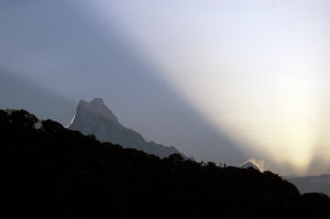
Rays from the rising sun illuminate the snow-clad peak of Annapurna II (7939 m), the second-tallest mountain in the Annapurna Range, here seen from the Upper Marsyangdi Valley. (Photos copyright © by Kaj Halberg)
Machhapuchhare (6993 m) is sacred to Hindus and may not be scaled. In Nepali, the name means ‘fishtail’, given in allusion to its twin peaks, which are combined by a curved ridge. (Photos copyright © by Kaj Halberg)
If you walk around the Annapurna Range, you must cross over the pass Thorung La (5415 m). In this picture, morning sun illuminates snow-clad mountains around the pass. (Photo copyright © by Kaj Halberg)
Eroded gullies near the top of Thorung La. (Photo copyright © by Kaj Halberg)
Evening clouds, moving across the Annapurna Mountains, seen from the Jhong River Valley, Mustang. (Photo copyright © by Kaj Halberg)
Yaks, grazing in front of the mountain Khatung Kang (6,488 m), Jarsang Khola Valley, Annapurna. The domestication of the yak is described on the page Animals: Animals in culture and religion: Bovidae. (Photo copyright © by Kaj Halberg)
Nilgiri (7061 m), partly hidden in morning clouds, Kali Gandaki Valley, Annapurna. (Photos copyright © by Kaj Halberg)
Ladakh is a barren land in north-western India. Geologically it constitutes a part of the Tibetan Plateau. This outlying part of the Himalaya is characterized by sharply rising sedimentary rocks, which have been eroded into any imaginable shape.
Evening light and shadows on mountains near Pang, Ladakh. (Photo copyright © by Kaj Halberg)
Jagged mountains along the Shila River Valley, Ladakh. (Photo copyright © by Kaj Halberg)
A dark cloud stands in great contrast to snow-clad mountains around Tso Kar, a high-altitude saline lake in Ladakh. (Photo copyright © by Kaj Halberg)
Buddhist stupas, chortens, and pagodas are all structures, whose various parts symbolize the elements, the base representing soil, the dome water, the rings or squares above the dome fire, the half-moon air, and the uppermost point space, sometimes depicted as a small sun.
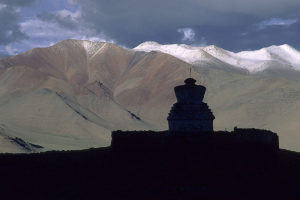
Chortens are the Tibetan variety of stupas. Early in the morning, this chorten stands out against the barren hills surrounding Tso Kar. (Photo copyright © by Kaj Halberg)
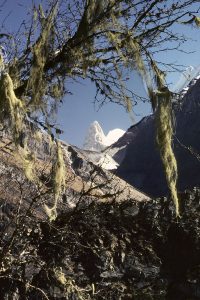
Changabang (6864 m) is a striking white granite peak in Nanda Devi National Park, Uttarakhand. The branches of the Himalayan birch (Betula utilis) in the foreground are draped with old man’s beard lichens (Usnea). A hike in this park is described on the page Travel episodes – India 1982: Pleasures of Nanda Devi. (Photos copyright © by Kaj Halberg)
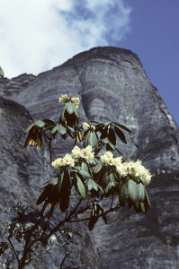
This black rock wall in the Barun Valley, eastern Nepal, has been named Neh. The plant in the foreground is Rhododendron wightii, described on the page Plant families etc.: Rhododendrons. A hike in the Makalu-Barun National Park is related on the page Plants – Plant hunting in the Himalaya: The rhododendron valley. (Photo copyright © by Kaj Halberg)
Mountains in the Great Himalayan National Park, Himachal Pradesh. (Photo copyright © by Kaj Halberg)
Other Asian mountains
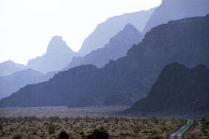
Misty mountains, Wadi Rum, Jordan. (Photo copyright © by Kaj Halberg)
In the summer 1999, I joined a group of Scandinavians on a hike in the Tien Shan Mountains of Kyrgyzstan. This picture shows mountains, snow, and fog in the Kaska Su Valley. (Photo copyright © by Kaj Halberg)
The Alborz (Elburz) is a major mountain range in northern Iran, stretching about 900 km from the border of Azerbaijan along the southern coast of the Caspian Sea to north-eastern Iran, near the borders of Turkmenistan and Afghanistan. A stay in these mountains is described on the page Travel episodes – Iran 1973: Car breakdown at the Caspian Sea.
Snow-covered landscape in the Alborz Mountains, with poplars (Populus) in the foreground. (Photo copyright © by Kaj Halberg)
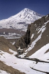
Mount Damavand (5671 m) is the highest peak in the Alborz Mountains. (Photo copyright © by Kaj Halberg)
A lake has been formed in the caldera of the volcano Gunung Rinjani (3727 m), Lombok, Indonesia. (Photo copyright © by Kaj Halberg)
Gunung Rinjani in morning mist. (Photo copyright © by Kaj Halberg)
The highest peak in the mountain range Western Ghats, stretching from Gujarat southwards along the west coast of India to the southern tip of the country, is Anaimudi (2695 m) in Kerala, here seen with tea plantations in the foreground. (Photo copyright © by Kaj Halberg)
At 5,123 m, Ağrı Dağı is the highest mountain in Turkey, its peak covered in an eternal ice cap. Ağrı Dağı has been identified as the mythical Mount Ararat of the Bible, where Noah’s Ark landed after the Great Deluge.
“And the Lord said unto Noah, ”Come thou and all thy house into the ark; for thee have I seen righteous before me in this generation. Of every clean beast thou shalt take to thee by sevens, the male and his female; and of beasts that are not clean by two, the male and his female. Of fowls also of the air by sevens, the male and the female; to keep seed alive upon the face of all the earth. For yet seven days, and I will cause it to rain upon the earth forty days and forty nights; and every living substance that I have made will I destroy from off the face of the earth.” (Genesis, 7.1-4)
In Ancient Palestine, a ‘clean beast’ was any animal that would chew the cud and have a completely split hoof, i.e. cattle, sheep, goats, and other members of the family Bovidae, whereas ‘unclean beats’ were other animals.
Mount Ağrı Dağı. (Photo copyright © by Kaj Halberg)
Limestone mountains, reflected in a lake, near Tam Coc, Ninh Binh Province, Vietnam. (Photo copyright © by Kaj Halberg)
Sunrise behind Gunung Abang (2155 m), third-highest mountain in Bali, Indonesia. (Photo copyright © by Kaj Halberg)
Morning fog around Mount Girnar (1145 m), Junagadh, Gujarat, India. (Photo copyright © by Kaj Halberg)
Yangshuo County in the Guangxi Zhuang Province, southern China, is known for its dramatic limestone formations.
House boats with drying fishing nets along the Li River, with limestone mountains and bamboo forests in the background, near Yangshuo City. (Photo copyright © by Kaj Halberg)
Limestone mountains along the Li River. (Photo copyright © by Kaj Halberg)
Rainbow in front of limestone mountains, Li River. (Photo copyright © by Kaj Halberg)
Adam’s Peak (2243 m), på singalesisk kaldt for Sri Pada, er et bjerg i det sydvestlige Sri Lanka, som er helligt for tilhængere af tre religioner. På toppen findes en fordybning i klippen, som både kristne og muslimer hævder er et fodaftryk, der blev sat af Adam, da han og Eva blev fordrevet fra Edens Have efter Syndefaldet. Buddhisterne derimod påstår, at det stammer fra Buddha, da han ifølge overleveringen gæstede Sri Lanka.
Adam’s Peak (2243 m), in Sinhalese called Sri Pada, is a mountain in south-western Sri Lanka, sacred to followers of three religions. In a rock on the summit is a depression, shaped like a footprint. Christians and Muslims alike maintain that Adam made this footprint, when he and Eve were expelled from the Garden of Eden after The Fall. Buddhists claim that the Buddha made the footprint when he, according to legend, visited Sri Lanka.
An area around the peak, covering about 224 square kilometers, was declared a wildlife sanctuary in 1940, named Peak Wilderness Sanctuary.
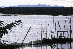
On a clear day, Adam’s Peak is seen in the far distance, with the Bolgoda Lake and fishing nets in the foreground, south-western Sri Lanka. (Photo copyright © by Kaj Halberg)
Cloud around the pointed summit of Adam’s Peak at dawn. (Photo copyright © by Kaj Halberg)
Mountains and islands on the Aegean Coast at Fethiye, south-western Turkey. (Photo copyright © by Kaj Halberg)
Yu Shan (‘Jade Mountain’) (3952 m) is the tallest mountain in Taiwan, and also in the Far East. In the foreground dead Chinese hemlocks (Tsuga chinensis). This tree is described on the page Plants: Ancient and huge trees. (Photo copyright © by Kaj Halberg)
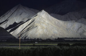
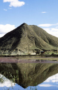
Barren mountains around the city of Shigatse, Tibet. (Photos copyright © by Kaj Halberg)
Gunung Kinabalu (4094 m) in Sabah is the highest mountain in Borneo. A hike up this mountain is related on the page Travel episodes – Borneo 1985: A hike up Gunung Kinabalu. (Photo copyright © by Kaj Halberg)
Following a heavy downpour, a double rainbow appears in front of Gunung Kinabalu. (Photo copyright © by Kaj Halberg)
Misty mountains, Mei Shan (‘Plum Mountains’), Guizhou Province, China. (Photo copyright © by Kaj Halberg)
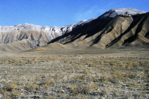
Barren desert mountains, near Xegar, southern Tibet. (Photo copyright © by Kaj Halberg)
Blurred by morning mist, tourists are descending the volcano Gunung Bromo, Java, Indonesia. (Photo copyright © by Kaj Halberg)
Eroded mountains near the huge salt lake Tuz Gölü, central Turkey. (Photo copyright © by Kaj Halberg)
Australasia
Tongariro National Park is situated in the southern part of the North Island of New Zealand, centered around three active volcanoes, Ruapehu (2797 m), Ngauruhoe (2291 m), and Tongariro (1978 m). This park, which covers 786 km2, was established as early as 1887, thus being among the oldest national parks in the world. For the major part of the year, the higher areas of the park are covered in snow.
In fact, Ruapehu is a name that includes a number of peaks, of which the tallest is Tahurangi (2797 m), whereas a striking pointed peak is Girdlestone (2658 m). Initially, this mountain was named Little Matterhorn Peak by Hubert Earle Girdlestone (1879-1918), a New Zealand explorer and war hero, who was killed in France in 1918. His friends installed a plaque on the mountain in 1922, renaming it Girdlestone Peak.
A snow-covered Ruapehu, seen from the south. The pointed mountain to the right is Girdlestone Peak. (Photo copyright © by Kaj Halberg)
Alpenglow on Girdlestone Peak. Alpenglow (from German Alpenglühen) is an optical phenomenon, which occurs at sunrise and sunset, when the scattered light from the sun, situated just below the horizon, lights up mountain sides and snow patches, while the foreground is in darkness. (Photo copyright © by Kaj Halberg)
Mount Taranaki is a dormant volcano on the west coast of the North Island, New Zealand. This striking mountain rises to a height of 2,518 m from the surrounding lowland. It was named Taranaki by the Maori, from the words tara (‘mountain peak’), and, presumably, ngaki (‘shining’), alluding to its snow-covered peak.
Until recently, the official name of this mountain was Egmont, thus named by British explorer and captain James Cook (1728-1779), in honour of John Perceval, 2nd Earl of Egmont (1711-1770), who, as former First Lord of the Admiralty, had supported the search for Terra Australis Incognita (‘Unknown Southern Lands’).
Mount Taranaki. (Photo copyright © by Kaj Halberg)
North America
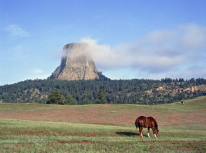
Devil’s Tower is a rock formation in north-eastern Wyoming, presumably the eroded remnant of a laccolith, a large mass of magma intruding through sedimentary rock. As the magma cooled, 6-sided (sometimes 4-, 5-, and 7-sided) vertical columns formed. This amazing rock rises dramatically above the Belle Fourche River, 265 m high from base to summit.
For hundreds of years, this rock has been sacred to local peoples, such as Lakota, Cheyenne, and Kiowa, and it appears in the mythologies of several other tribes. Today, it is the site of tribal vision quests and other rituals, and in the surrounding grasslands, Sun Dances and other tribal ceremonies are performed.
Vision quests are described in depth on the page Book: Seed of Knowledge, Stone of Plenty, Chapter 3.
Devil’s Tower. (Photos copyright © by Kaj Halberg)
Lassen Peak, or Mount Lassen (3187 m), is an active volcano, situated in Lassen Volcanic National Park, northern California. It is the southernmost active volcano in the Cascade Volcanic Arc, which stretches from southern British Columbia to northern California. The peak was named for Peter Lassen (1800-1859), a Danish blacksmith and pioneer, who arrived in California in the 1830s.
On May 19, 1915, an eruption of the volcano created a lava avalanche, which caused a huge mudflow to rush down the Lost Creek and Hat Creek Valleys, covering 50 km of land in silt, destroying homes, and creating Hat Lake.
Lassen Peak, seen from Upper Meadow, near King’s Creek, Lassen Volcanic National Park. (Photo copyright © by Kaj Halberg)
In this picture, Lassen Peak is reflected in Hat Lake. (Photo copyright © by Kaj Halberg)
Stunted whitebark pines (Pinus albicaulis) on Lassen Peak. This tree is described on the page Plants: Ancient and huge trees. (Photo copyright © by Kaj Halberg)
El Capitan, Half Dome, and other remarkable granite rocks in Yosemite National Park, Sierra Nevada, eastern California, were sculpted by glaciers during the last Ice Age, 10,000 to 15,000 years ago.
El Capitan (Spanish for ‘captain’ or ‘chief’) is a vertical rock, about 914 m from base to summit. Its name is a rough translation of the local Native American name for the rock.
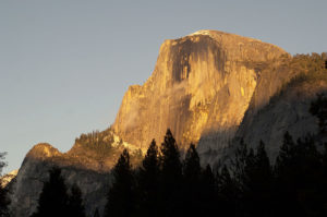
Half Dome is named after its shape. One side is a sheer rock face, whereas the other three sides are smooth and round, making the rock appear like a dome, cut in half.
An Ahwahneechee legend relates that, long ago, two travellers, Tissiak and her husband Tokoyee, were quarrelling with each other. He became so enraged that he began beating her, which made her so angry that she hurled her basket of acorns at him. As they stood facing each other, they were turned to stone for their wickedness. The acorn basket (Basket Dome) lies upturned beside Tokoyee (North Dome), and the rock face of Tissiak (Half Dome) is stained with her tears.
The plant life of Yosemite National Park and surrounding mountains is described on the page Plants: Flora in the Sierra Nevada.
El Capitan (left) and Half Dome (in the background). (Photo copyright © by Kaj Halberg)
Half Dome, illuminated by evening sunshine. (Photo copyright © by Kaj Halberg)
Mountains around Yosemite Fall (739 m), the highest waterfall in North America. (Photo copyright © by Kaj Halberg)
Mountains and clouds, Blosseville Coast, eastern Greenland. (Photo copyright © by Kaj Halberg)
Mountain, reflected in Somes Sound, Acadia National Park, Maine. (Photo copyright © by Kaj Halberg)
Mount St. Helens, an active volcano in Washington State, western United States, exploded in 1980, blowing away one side of the mountain. The eruption destroyed vast areas of the surrounding landscape, killing millions of trees. The authorities decided to protect the area, and the logs were not allowed to be removed.
Mount St. Helens with Lake Spirit in the foreground, photographed in 1992, 12 years after the eruption. (Photo copyright © by Kaj Halberg)
The Bubbles, elevation around 260 m, and Jordan Pond, early in spring, Acadia National Park, Maine. (Photo copyright © by Kaj Halberg)
Mountains in Tonto National Forest, Arizona. (Photo copyright © by Kaj Halberg)
Central America
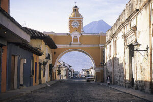
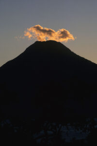
The volcano Agua (3766 m), seen behind the Arco de Santa Catarina, from 1694, Antigua, Guatemala. (Photo copyright © by Kaj Halberg)
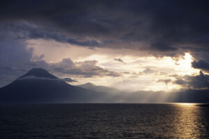
The extinct volcano San Pedro (3020 m), Lago Atitlán, Guatemala. (Photo copyright © by Kaj Halberg)
Towards evening, small clouds form around the peak of San Pedro, giving the illusion that the volcano is still active. (Photo copyright © by Kaj Halberg)
The volcano Arenal (1670 m), Cordillera de Tilarán, Costa Rica, behind a tree stump, which is overgrown by Monstera and other epiphytes. (Photo copyright © by Kaj Halberg)
South America
The Andes
This mountain range is the longest in the world, stretching approximately 9,000 km along the west coast of South America. The highest point is Aconcagua (6962 m) in Argentina, the tallest peak outside Asia. The pictures below are all from the Chilean Andes.
Mountains in Monumento Natural El Morado, southeast of Santiago. (Photo copyright © by Kaj Halberg)
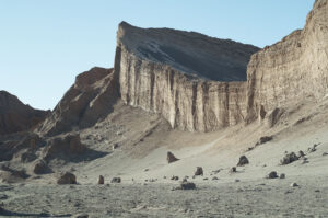
Valle de la Luna National Park, near San Pedro de Atacama. (Photo copyright © by Kaj Halberg)
Mountains around Embalse El Yeso, southeast of Santiago. (Photos copyright © by Kaj Halberg)
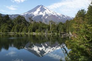
The volcano Llaima (3125 m), reflected in a small lake named Lago Captren, Conguillio National Park, east of the city Temuco. (Photo copyright © by Kaj Halberg)
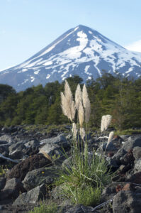
Llaima and the grass species Cortaderia araucana, growing in an old lava flow, Conguillio National Park. This species is described on the page Plant families etc.: Grasses. (Photo copyright © by Kaj Halberg)
(Uploaded October 2026)